In the early 2000s, the Federal Aviation Administration realized that as air travel was speeding into the new millennium, many of the systems that controlled it were relics of the past. Useful relics, yes, but the system was in great need of modernization with the number of flights growing year after year.
The Next Generation Air Transportation System, or NextGen, was humbly born deep in the 110-page “Vision 100 — Century of Aviation Reauthorization Act” in December 2003. The next month, the Department of Transportation announced plans for a new, multi-year, multi-agency effort to develop an air transportation system for the year 2025 and beyond.
And on Dec. 15, 2004, the DOT unveiled the Integrated Plan for the Next Generation Air Transportation System, which laid out goals, objectives, and requirements necessary to create the NextGen system.
Over the next two decades, NextGen technology and programs have revolutionized the National Airspace System, resulting in a better travel experience, a boost to the aviation economy, and enhanced safety (Why NextGen Matters).
Benefits
The benefits of NextGen are many. The program enhances safety, reduces fuel use and aircraft exhaust emissions, and is vital to preserving aviation’s significant contributions to our national economy.
The FAA’s top priority is ensuring safe skies and airfields, and NextGen innovation and improvements are delivering just that. NextGen is providing air traffic managers and pilots with the tools to proactively identify and resolve weather and other hazards.
Flying is becoming quieter, cleaner, and more fuel-efficient. Operators are beginning to use alternative fuels and new equipment and procedures, reducing our adverse impact on the environment. More precise flight paths are also helping limit the numbers of people impacted by aircraft noise.
Airports are economic engines for the communities they serve, bringing visitors and commerce. NextGen is providing increased access, predictability and reliability, enhancing airport operations across the country.
Contributions to the National Airspace System (NAS)
NextGen is leveraging new and existing National Airspace System capabilities to streamline aviation and aerospace operations and the dissemination of information systems. This includes systems dealing with flight, weather, communications, and airport and airline operations.
NextGen transformation requires streamlined data communications capabilities and the ability to manage the efficient flow of information through the NAS. System Wide Information Management (SWIM) is the platform that shares up-to-date and identical information among pilots, air traffic controllers, airline dispatchers, the military, government agencies and other users of the NAS.
SWIM also processes information from different kinds of systems, such as airport operational status, weather information, flight data, status of special use airspace and airspace system restrictions.

Procedures

The procedures for guiding and piloting an aircraft from gate to gate become much more streamlined thanks to NextGen programs, chiefly from improved operations in the terminal, on the surface, and in the air, as well as optimized profile descent.
All aircraft and surface vehicles are tracked electronically, allowing for the taxi routing process to be automated and, thus, more efficient. Pilots and controllers have less need to communicate via radio. And new NextGen technology allows for aircraft to take multiple departure paths for each runway, increasing departure capacity.
More aircraft can efficiently and safely cruise the skies at once thanks to NextGen systems that determine the optimal path based on wind, destination, weather, and traffic.
Descents will no longer be the drawn-out process that they are today. Instead, the arrival sequence is planned hundreds of miles in advance by NextGen systems, and aircraft are put on precise vertical and horizontal paths from descent point to final approach.
Surveillance Broadcast Services

Automatic Dependent Surveillance Broadcast (ADS-B)
- Provides surveillance and traffic situational awareness simultaneously to pilots and ATC
- Designed to improve safety, capacity, and efficiency in the NAS while providing a flexible, expandable platform to accommodate future air traffic growth

Traffic Information Service Broadcast (TIS-B)
- Broadcasts surveillance data to equipped aircraft and provides ADS-B aircraft with position reports from secondary surveillance sources to non-ADS-B equipped aircraft
Flight Information Service Broadcast (FIS-B)
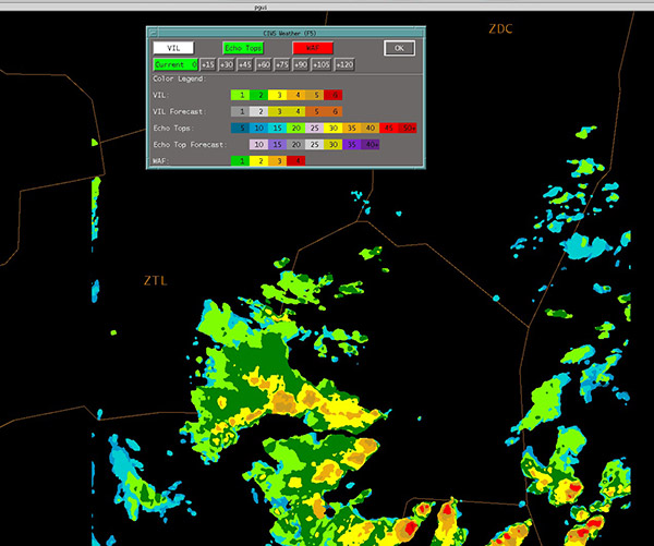
- Transmits graphical national weather service products, temporary flight restrictions, and special use airspace information via Universal Access Transceiver (UAT) equipment on 978 mHz
- Flight Based Interval Management

ADS-B Ground Based Transceivers
- Already providing service to two-thirds of the country
- Transmit Traffic Information Service-Broadcast (TIS-B), Flight Information Services-Broadcast (FIS-B), and Automatic Dependent Service-Broadcast (ADS-B)
- The service for pilots is free
- Also part of Infrastructure
Unmanned Aircraft Systems
Private Use
- Reconnaissance/surveillance
- Small UAS
- Expected to experience high near-term growth because of versatility and relatively low initial cost
Public Use
- Border protection
- Customs and Border Protection (CBP) uses UAS to identify smugglers
- Fire Department
- UA flies over forest fires and takes infrared images of fires to aid in fire fighting efforts
- Law enforcement
- Search and rescue
- UAVs lay an increased role in search and rescue, including damage assessment
- Demonstrated by the use of UAVs during the 2008 hurricanes that struck Louisiana and Texas
- Weather (Wx) data collection
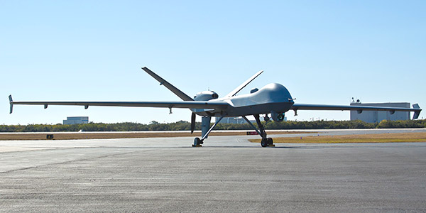
- NOAA uses UAS to gather data from severe weather systems, such as hurricanes, to aid in understanding of how such patterns originate
- Assessing natural disasters
Commercial Use
- Aerial photo
- Food delivery
- Advertising
- Crop dusting and monitoring
- Communications and broadcasting
- Cargo
- Infrastructure monitoring (waterways, pipelines, electrical grids, ports, etc.)
- Reconnaissance/surveillance
